Trail Walking La Roche-Maurice - La Roche Maurice - Photo

Promenez-vous au bout du monde !

© OpenStreetMap contributors
Length
Length
8.4 km
Max alt
Max alt
131 m
Uphill gradient
Uphill gradient
142 m
Km-Effort
Km-Effort  
10.3 km
Min alt
Min alt
19 m
Downhill gradient
Downhill gradient
153 m
Boucle
Boucle
Yes
Creation date :
2019-07-21 08:24:19.107
Updated on :
2019-07-29 06:49:06.816

(0 Reviews)

Walking
Walking
2h02
Difficulty : Very easy

Scan this QR Code to open this trail in the SityTrail application

FREE GPS app for hiking

Logo SityTrail SityTrail

IGN / Geographical institutes

Download SityTrail from the App Store Download SityTrail from Google Play

Logo SityTrail SityTrail World

The world is yours!

Download SityTrail from the App Store Download SityTrail from Google Play Download SityTrail on Huawei AppGallery

About

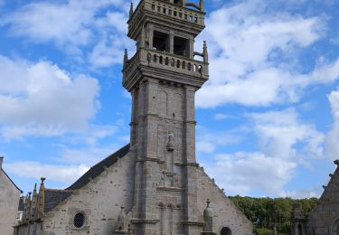
Trail Walking of 8.4 km to be discovered at Brittany, Finistère, La Roche-Maurice. This trail is proposed by Balades en Finistère.

Description

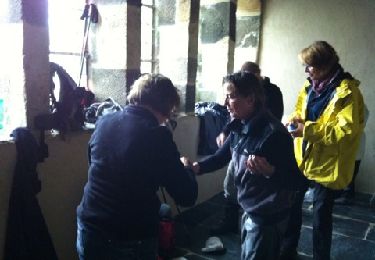
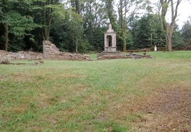
Randonnée en boucle au départ de la Roche Maurice.
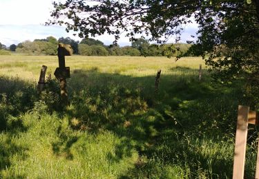
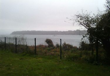
On suit au départ un sentier en direction de La Martyre en suivant le ruisseau Morbic, un affluent de l'Elorn. Le retour s'effectue par chemin et petites routes.

Elevation profile

Photos

Positioning

Country:
France
Region :
Brittany
Department/Province :
Finistère
Municipality :
La Roche-Maurice
Location:
Unknown
Start:(UTM)
410880 ; 5369624 (30U) N.

Trails nearby

Trail Walking La Roche-Maurice - LA MARTYRE LANDERNEAU - Photo
Walking
donnay

Walking

Medium
(1)
La Roche-Maurice, Brittany, Finistère, France
17.9 km | 21 km-effort
5h 18min
Yes
Trail Walking Trémaouézan - Tremaouézan, tourbière et zone humide de Langazel - Photo
Walking

Walking

Very easy
Trémaouézan, Brittany, Finistère, France
8.2 km | 8.9 km-effort
1h 58min
Yes
Trail Other activity Landerneau - maison blanche brest.phare du delec - Photo
Other activity
elianette

Other activity

Difficult
Landerneau, Brittany, Finistère, France
36 km | 44 km-effort
6h 14min
No
Trail Walking Saint-Servais - Yann d argent - Photo
Walking
jmboucher

Walking

Difficult
Saint-Servais, Brittany, Finistère, France
13.7 km | 16.1 km-effort
3h 40min
Yes
Trail Nordic walking Plounéventer - pont Christ - Photo
Nordic walking
elianette

Nordic walking

Very easy
Plounéventer, Brittany, Finistère, France
12.3 km | 15.2 km-effort
2h 22min
Yes
Trail Running Landerneau - Autour de Landerneau - Photo
Running
tracegps

Running

Difficult
Landerneau, Brittany, Finistère, France
15.9 km | 19.3 km-effort
1h 30min
Yes
Trail Walking Pencran - Canoë +chenal ldn - Photo
Walking
fiorepatrick

Walking

Medium
Pencran, Brittany, Finistère, France
6.1 km | 6.6 km-effort
1h 14min
Yes
Trail Walking Trémaouézan -  Trémaouézan - Photo
Walking
siboutchou

Walking

Very easy
Trémaouézan, Brittany, Finistère, France
7.9 km | 8.5 km-effort
1h 51min
Yes
Trail Walking Saint-Servais - Saint Servais - Chateau de Brézal - Photo
Walking
tracegps

Walking

Difficult
(1)
Saint-Servais, Brittany, Finistère, France
15 km | 18.5 km-effort
4h 30min
Yes


Close
My subscriptions